After a few beautiful, then windy and rainy days in Port Fitzroy, we
moved on to Smokehouse Bay. Unfortunately the bath, that is heated by a wood
fire, was not functioning, and there was a total fire ban, so we couldn't have
a bonfire, so we didn't get to enjoy the more unique aspects of this site. Axel
was ok with the bath being out of order, as that meant he got to go more days
without bathing.
Then through the narrow Man of War passage and into an area of
incredible fishing. We anchored off Motutaiko Island for the afternoon so Gary
and Gigi could go spearfishing. I took the kayak out to explore the nooks and
crannies of the rocks in the island, then Axel and I fished off the boat and
caught a few snapper. He got the only one big enough to keep. Gary speared a big
kingfish (more than 1 meter) and a lobster. On our way to Whangaparapara
Harbour we saw lots of blue penguins and dolphins, and we caught a kahawai. In Whangaparapara Harbour we grabbed a mooring,
that Gigi noticed was covered in mussels, so once we were secure, she hopped in
the dinghy and harvested a bucket full of mussels. With all this great seafood,
we had an amazing feast.
The next day as we prepared for our big hike to the top of Great
Barrier Island, we checked the mooring and saw it was chafing, so we moved to
anchored off the pier, but the strong south wind made this an uncomfortable
location. I checked the weather forecast, as we had cell coverage here in the
middle of the harbor, and saw it was supposed to blow 35 knots, so we moved
again to a better protected part of the harbor. The hike would have to wait
until tomorrow. Fortunately when we woke up the next day, then wind was blowing
lightly from the north, so we moved the boat back to the center of the harbor
and headed in for our hike.
For PE for the kids school this month, we set a family goal to
hike 20 miles, we way surpassed that goal, with our final hike being the
biggest by far. Gigi did a great job describing the hike, so here is what she
wrote.
One large hike we did was an
overnight trip up to the highest point on Great Barrier Island. The first day
we drove from Whangaparapara to the head of the hot springs trail then walked,
loaded down with heavy backpacks, 45 mins up the very flat and well maintained
trail to the hot springs where we soaked before heading off on the main part of
the hike. From the hot springs we hiked 3 hours through green forest and hot
hillsides passing beautiful lookouts and historical sites to the Mt. Heale Hut
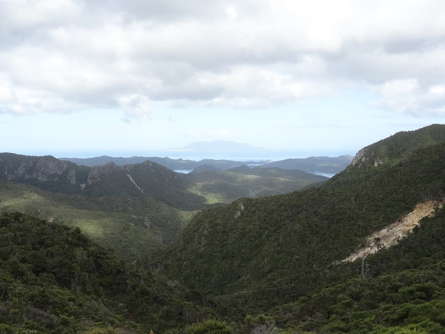
where we stayed the night. The view from the Mt. Heale Hut was stunning;
looking across numerous green hills and valleys you could see down to the ocean
where several boats were nestled in Whangaparapara harbor and as the sun set
the open ocean turned to gold and the hills faded into grey. The next day we
walked up over 900 stairs to the summit of the mountain which provided a 360
degree view of the entire island. We hiked back down to the hut, picked up our
bags, and started back down the trail we had taken the day before. At the
second fork in the road we changed our course from the previous day and headed
down the tramline track, stopping to swim in a waterfall on the way. In all it
took 5 hours and 30 minutes from the hut to the summit and back to the
boat. The hike was challenging because
of its length and steep slope and left me tired and sore, but was definitely
worth it.
We are continually amazed at the engineering that the Kiwis put
into their hiking trails. On this hike there were long boardwalks through the wetlands,
lots and lots of stairs, and bridges over rivers. The cabin we stayed in
appeared to be fairly new and was perfectly maintained. It had 2 sleeping rooms
each with a long bunk with mattresses that could hold 5 people, gas stoves with
pots and pans, a couple big tables for eating, running water, and electrical
lights. It was a great hike, but I am definitely feeling it in my sore muscles.
Cheers,
Julie
view from Mt. Hobson
DoC hut and Mt Heale in the background
view from the DOC Hut
At the summit of Mt. Hobson
Mt. Hobson is the tallest point on the left and Mt. Heale is the jagged point in front and to the right


